
Nor'easter turns dangerous as East Coast braces for winds, flooding and blackouts
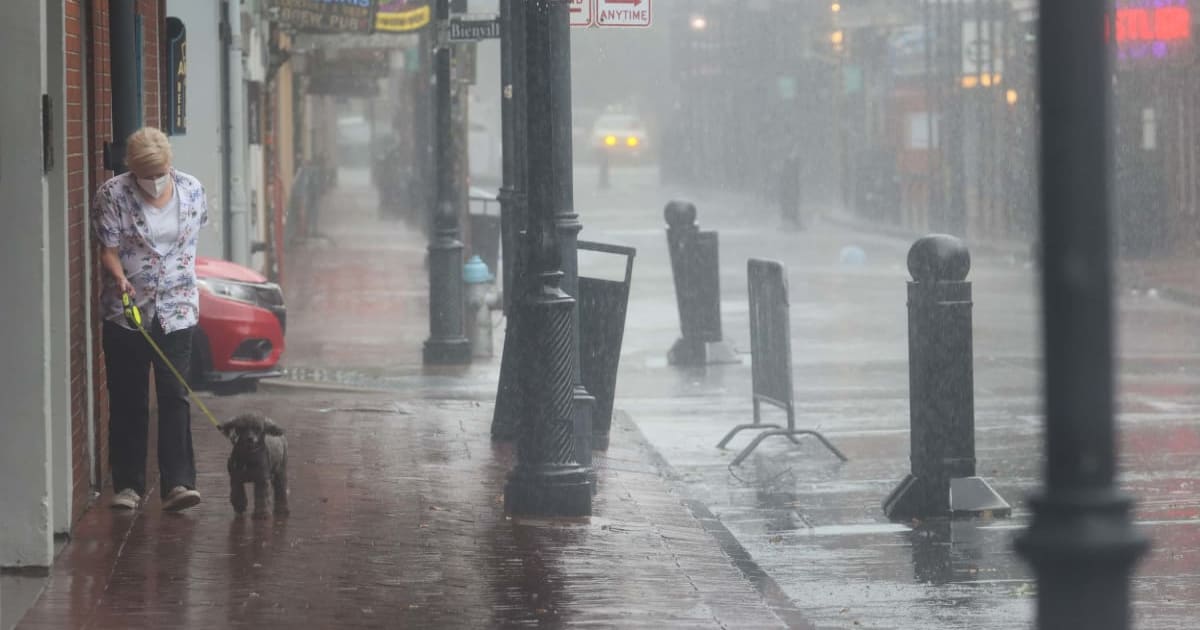
NEW YORK CITY, NEW YORK: A strengthening nor’easter was sweeping up the East Coast on Friday, September 25, as coastal areas already faced flooding, powerful surf and damage to roads along the storm’s path.
The system is forecast to grow more intense over the weekend, with stronger winds and recurring coastal flooding expected across parts of the Mid-Atlantic and New England.
Authorities in New York and New Jersey have declared emergencies, urging residents to take precautions now as conditions are expected to worsen.
For you and your family's safety, right now is your last chance to get ready before the nor'easter arrives. Here's what to expect today:
— NYC Emergency Management (@nycemergencymgt) September 25, 2026
💨 A Wind Advisory starts at 2 p.m., with gusts of 40 to 50 mph that could bring down trees, limbs, and power lines.
🌧️ Rain moves in this…
East Coast braces for impact
The nor’easter has already caused trouble along North Carolina’s Outer Banks, where surging water and powerful waves have flooded coastal stretches and affected local roads.
Near Pea Island, seawater spilled onto North Carolina Highway 12, forcing authorities to shut down part of the key coastal route.
Other sections of the North Carolina shoreline have also seen flooding and erosion, signaling that the nor’easter could continue causing problems as it moves farther north.
Its impact is now expected to spread beyond the Carolinas.
Pics from Pea Island this morning. The road is currently covered in 4' of water in some areas, as well as deep sand. At this point, it is impossible to assess the extent of any road damage, but once we do, we will have a better idea of repair/reopening options. pic.twitter.com/6lx5zQBSzk
— NCDOT NC12 (@NCDOT_NC12) September 25, 2026
The system is advancing toward the Mid-Atlantic and Northeast, putting a growing number of coastal communities on alert ahead of the weekend.
The threat is being driven by more than rainfall, with high tides, strong winds blowing from the ocean and rough surf combining to raise water levels along the coast.
Several high-tide periods could bring additional flooding, particularly from the northern Outer Banks through parts of southern New Jersey.
Farther north, coastal areas in New York and New England are also preparing for the storm’s arrival and the potential for worsening flooding.
I’m declaring a State of Emergency for Nassau, Suffolk, New York City and Westchester as this powerful coastal storm bears down on the region.
— Governor Kathy Hochul (@GovKathyHochul) September 25, 2026
We’re expecting dangerous coastal flooding, strong winds and potential power outages through the weekend.
Take this storm seriously.…
State of emergency declared
Coastal flood warnings are now in effect for Staten Island, Brooklyn, Queens and the Bronx, while Manhattan remains under a less severe flood advisory.
Winds reaching 40 to 50 mph could bring down tree limbs and power lines, creating the risk of scattered outages across affected areas.
A prolonged period of heavy rain, coastal flooding and strong winds will impact parts of New York through the weekend.
— Governor Kathy Hochul (@GovKathyHochul) September 25, 2026
The most significant impacts are expected along the coast from later tonight through Sunday.
Stay dry. Stay alert. Stay safe.
For real-time weather and… pic.twitter.com/8VrrcKSgxL
In New Jersey, Gov Mikie Sherrill has declared a State of Emergency across eight counties ahead of the storm, asking residents to remain vigilant and follow instructions from local authorities.
New York officials are also cautioning against unnecessary travel as worsening weather could make roads hazardous.
The storm’s gradual movement is another concern for communities along the coast.
In preparation for the Nor’easter, I’m declaring a State of Emergency for Atlantic, Burlington, Cape May, Cumberland, Middlesex, Monmouth, Ocean, and Salem counties – effective at 5:00 PM today.
— Governor Mikie Sherrill (@GovSherrillNJ) September 25, 2026
Starting tonight, the storm is expected to bring strong winds, heavy rain, and… pic.twitter.com/7bFIxCdYpT
Instead of quickly moving away, the system is expected to remain near the shoreline, potentially exposing coastal areas to strong winds and elevated water levels during several high-tide periods.
That could leave communities from the Carolinas to New England dealing with an extended stretch of flooding, erosion, powerful winds and possible power outages throughout the weekend.