Minnesota anti-ICE protesters face hypothermia risk as temperatures are expected to plunge
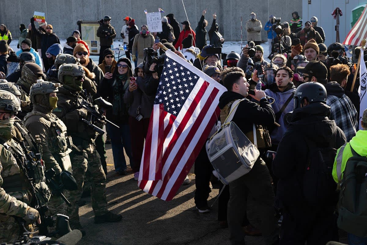
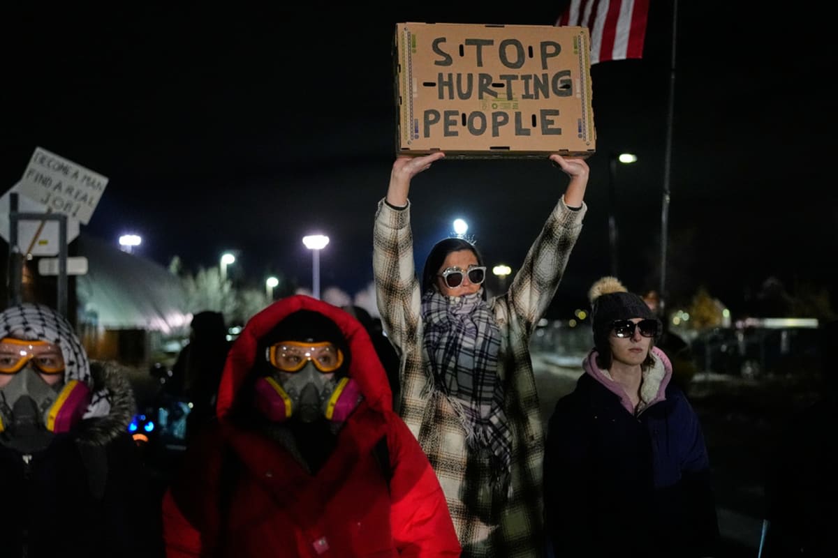
MINNEAPOLIS, MINNESOTA: As ICE protests continue to spill onto streets across Minnesota, plunging temperatures are putting demonstrators at serious risk.
Forecasts warn that wind chills could drop to -13°F in the Minneapolis area by the night of Saturday, January 17, raising the threat of hypothermia for anyone spending long hours outdoors, including protesters and US Immigration and Customs Enforcement (ICE) agents this weekend.
Minnesota protesters warned of extreme cold this weekend
Amid the rising tensions between ICE and Minnesota protesters, reports confirmed that this weekend’s extreme cold could be dangerous for anyone spending time outside in the Minneapolis area.
The National Weather Service in the Twin Cities warned that wind chills could "fall into the range of 30 below zero to 40 below zero Saturday morning and Monday morning" in parts of Minnesota.
In the Twin Cities, temperatures are expected to fall to -13°F on Saturday night. At these temperatures, frostbite can develop in just 15 minutes, National Weather Service meteorologist Brent Hewett told Newsweek.
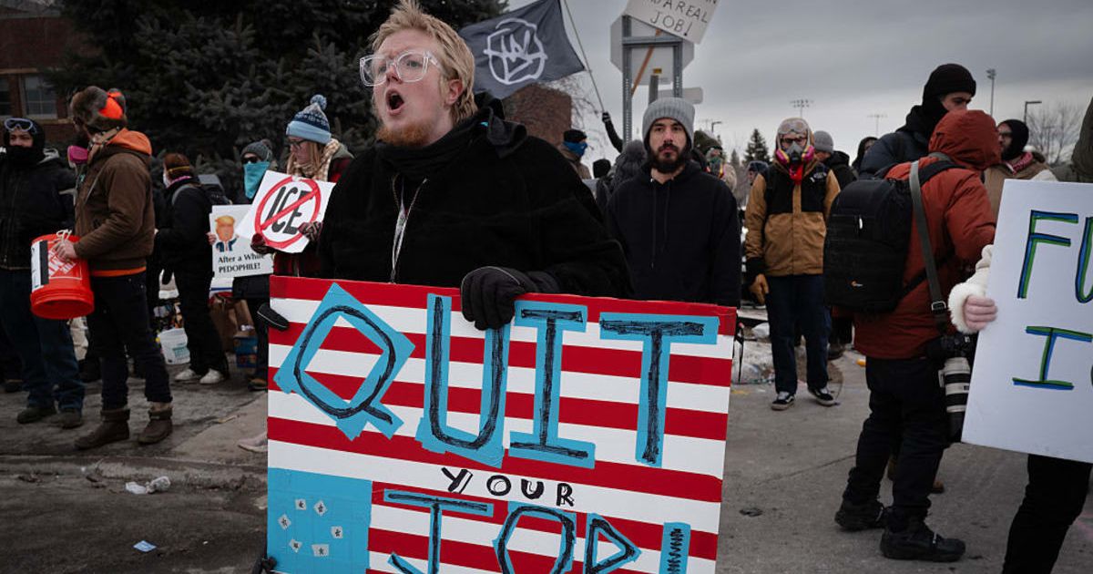
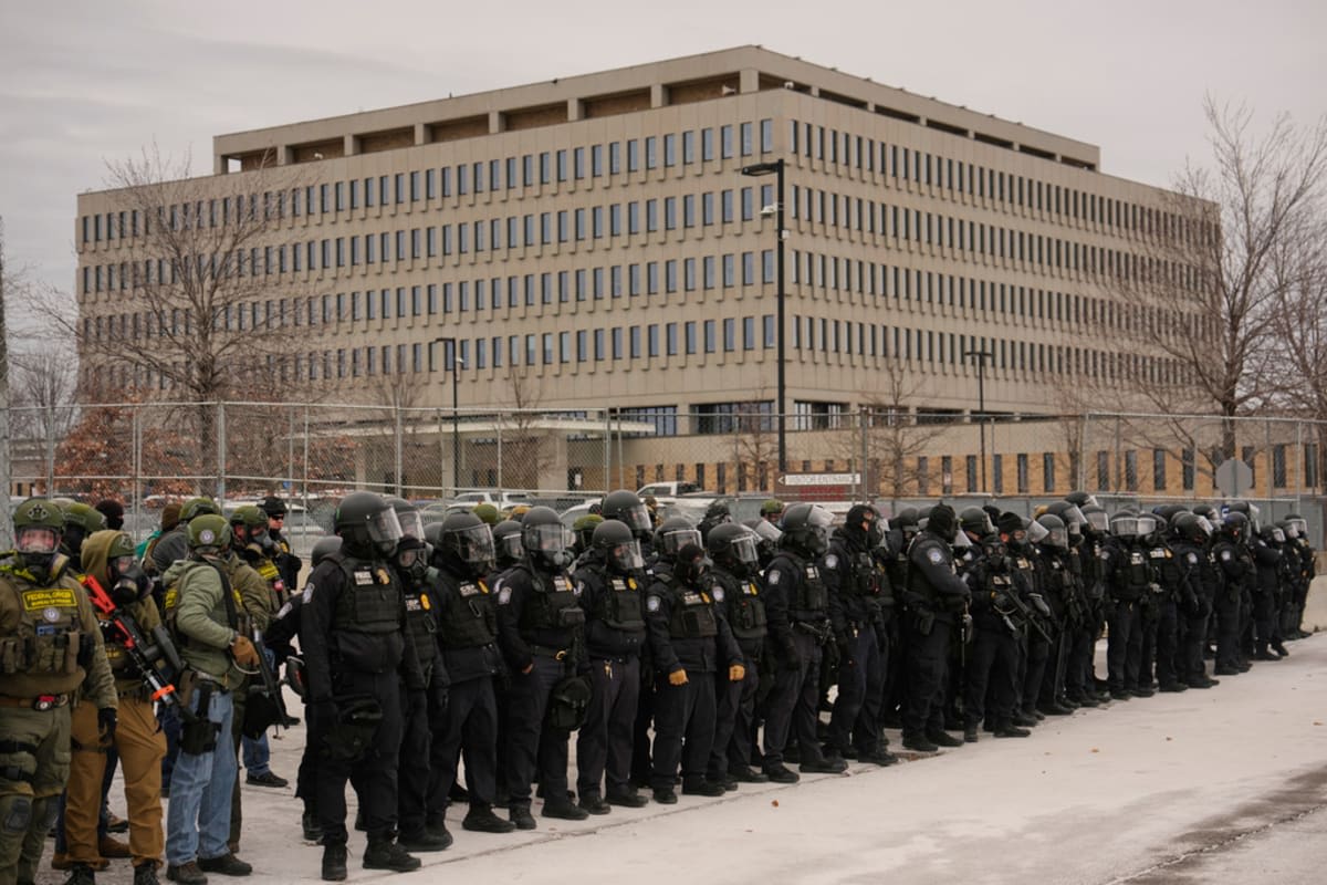
The rising tension between ICE agents and Minneapolis protesters began after an ICE agent fatally shot 37-year-old Renee Nicole Good on January 7 during a federal immigration enforcement operation in the city.
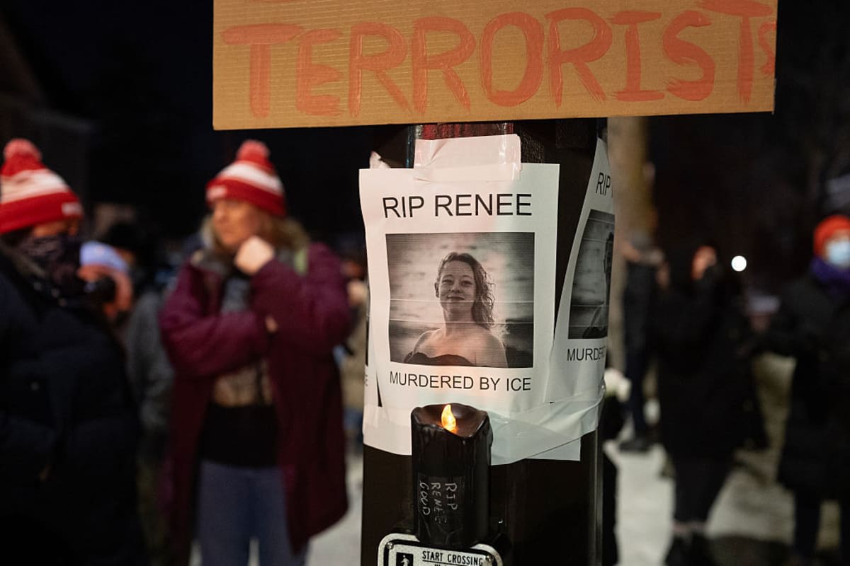
Good’s death sparked large protests and widespread criticism of ICE’s actions and the Trump administration’s immigration policies.
A week later, another federal officer shot a Venezuelan man in the leg during a Minneapolis operation, saying he fired in self-defense after a struggle in which the agent was attacked with a snow shovel and broom handle. That incident added fuel to the protests and further angered demonstrators who then gathered outside the Bishop Henry Whipple Federal Building and other federal sites linked to ICE operations.
National Weather Service issues warning as frigid cold moves in
The cold will intensify by Monday morning, when the “feels-like” temperature could reach -24°F. When wind chills hit minus 25 degrees, the National Weather Service (NWS) typically issues a cold weather advisory, though officials have not yet said whether one will be issued this weekend. If an advisory is announced, it would likely come on Sunday, ahead of the coldest conditions early Monday.
The NWS warned on X that "Frigid cold returns by tomorrow night and will last for several days."
Forecasts show that the Twin Cities’ feels-like temperatures will stay below zero throughout the entire weekend. While these temperatures are colder than usual, Hewett said mid- to late January is typically the coldest time of the year in Minneapolis. He added, "If we are going to have higher-end, more dangerous cold, arctic outbreaks, this is the time of year we would expect that."
Hypothermia: causes and health risks
Lower wind chill temperatures increase the risk of frostbite and hypothermia, according to the National Oceanic and Atmospheric Administration. Hypothermia occurs when a person’s body temperature drops below 95°F, while frostbite happens when skin and underlying tissue freeze after exposure to extreme cold.
Symptoms of hypothermia include shivering, slurred speech, shallow breathing, a weak pulse, poor coordination, and loss of consciousness. If the person does not warm up, hypothermia can become life-threatening.